Beynac to Castelnaud Trail: The Castle Route
The Beynac to Castelnaud hiking route is not one single trail with one fixed difficulty rating. It is a short riverside connection of approximately 4.04 km, or a substantially longer loop of up to 15.3 km through the Dordogne valley.
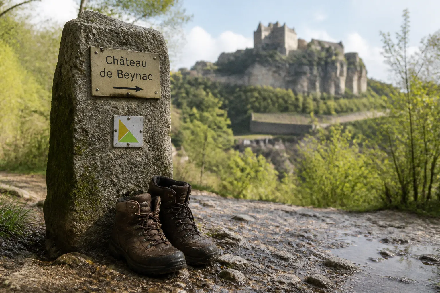
The difference is not cosmetic. It changes the walking time, elevation profile, return logistics and the number of landmarks included.
The direct route takes roughly one hour and has minimal elevation gain. The extended circuit takes around four hours and accumulates approximately 230 metres of ascent. Both connect two of the Dordogne’s most significant medieval fortresses, but they suit different days. One is an efficient castle-to-castle transfer. The other is a proper half-day hike.
The correct choice depends less on scenery than on available daylight, footwear, tolerance for uphill sections and whether the route finishes where you started.
The medieval corridor between Beynac and Castelnaud
Château de Beynac and Château de Castelnaud-la-Chapelle occupy opposing points in the same section of the Dordogne Valley. The villages sit within a landscape defined by the river, limestone escarpments, wooded slopes and agricultural land. The castles are close enough to connect on foot, but their elevated positions create a distinction between walking through the valley and reaching the monuments themselves.
Château de Beynac was originally built in the 12th century on a limestone cliff approximately 150 metres above the Dordogne River. That vertical position is the primary physical fact of the route. The riverside path can be comparatively easy; the final approach to the castle is not equivalent to the flat valley walking that precedes it.
Castelnaud-la-Chapelle has the same basic logistical issue. The village and castle are related destinations, not a single level walking surface. Visitors who judge the entire walking trail Beynac to Castelnaud by the first section beside the river can misread the return journey. The route has two separate components:
- the lower-level connection through the valley and countryside;
- the ascent into the village or castle area at either end.
This matters for families carrying equipment, walkers with limited mobility and anyone planning to complete the route in ordinary casual footwear. The castle interiors, village streets and elevated viewpoints are not interchangeable with the riverside section.
The direct route is short in distance, but the two castles are not positioned on the same level as the river.
The corridor also has a practical advantage. It concentrates several major Dordogne landmarks within a manageable walking area. A single outing can include Beynac, Castelnaud, sections of the riverbank, rural tracks and, on the longer option, the approach to La Roque-Gageac. This is a high-density walking zone rather than an isolated trail in open countryside.
Two routes, two different days
The most common planning error is to treat the 4.04 km direct route and the 15.3 km loop as variations of the same experience. They are better understood as two separate products.
| Route option | Approximate distance | Typical walking time | Elevation profile | Main use |
|---|---|---|---|---|
| Direct Beynac–Castelnaud connection | 4.04 km | About 1 hour | Minimal gain on the connecting section | Short transfer between the castles |
| Extended loop via La Roque-Gageac | Up to 15.3 km | Around 4 hours | Approximately 230 m of gain | Half-day landscape and castle circuit |
The 4.04 km direct route
The direct route is the efficient option. At approximately 4.04 km, it fits into a morning or afternoon without requiring a full hiking schedule. The estimated walking time is about one hour, assuming a steady pace and no extended stops.
That estimate should not be confused with the time required for a complete visit. It excludes the practical delays that accumulate around the route:
1. Walking from a parking area or accommodation to the actual trail access.
2. Reaching the castle entrances from the lower approach.
3. Stopping for photographs or river views.
4. Allowing time for village streets, signs and route-finding.
5. Returning to the original parking or accommodation point.
A one-hour connection can therefore become a much longer outing once the castles are included. The route distance is reliable as a planning basis; it is not a complete itinerary.
The direct option works particularly well when the priority is to see both fortresses without committing to a long loop. It also provides a controlled walking distance for visitors who are combining the route with a meal, a market visit or a separate activity later in the day.
The main weakness is transport symmetry. A point-to-point route does not return the walker to the starting location. Exact year-round public bus schedules between the two village centres should not be assumed. The return must be planned separately, either by arranging a second vehicle, using a pre-confirmed local transfer or treating the walk as part of a larger itinerary with a known endpoint.
The 15.3 km scenic loop
The longer loop connects Castelnaud-la-Chapelle, La Roque-Gageac and Château de Beynac. It can extend to approximately 15.3 km, with around 230 metres of elevation gain and a walking time of roughly four hours.
This is no longer a simple castle transfer. The route becomes a compact survey of the Dordogne Valley’s physical structure: river corridor, village edges, woodland, limestone terrain and elevated castle approaches. The extra distance gives the walk more geographical coherence. Instead of moving directly from one attraction to another, it shows how the settlements occupy the valley.
The 230 metres of ascent is moderate by mountain standards but material over a four-hour route. The load is not distributed evenly in the way a road cyclist might expect from a smooth gradient. Shorter climbs around villages, castle approaches and uneven rural paths can feel more demanding than the total figure suggests.
The loop is the better choice when:
- the aim is a half-day hike rather than a short connection;
- the group can manage repeated changes in surface and gradient;
- the return to the starting point has been confirmed;
- there is enough daylight for navigation and unplanned pauses;
- the castles are part of a wider landscape walk rather than the only objective.
It is less suitable when the day already contains several fixed-time visits. A four-hour walking estimate leaves little margin if combined with castle interiors, lunch reservations and long drives.
Landmarks that justify the longer circuit
The value of the extended Dordogne Valley castle hike lies in the spaces between the headline attractions. The route is not simply a line drawn between two châteaux. It passes through a landscape in which medieval construction, water management and river access remain legible.
Château de Beynac and the limestone cliff
Beynac’s position above the river is its defining structural feature. The fortress was built on a limestone cliff approximately 150 metres above the Dordogne. The elevation provided defensive advantage, but it also determines the walking experience today.
A visitor approaching from the valley must distinguish between reaching the settlement and reaching the castle itself. The final approach is a separate physical task. It involves a climb and should be assessed according to footwear, weather, age and mobility rather than the apparent simplicity of the valley route.
The high position also changes the visual reading of the landscape. From below, the castle dominates the cliff. From the upper approach, the relationship reverses: the river becomes a linear reference through the valley, while the surrounding slopes reveal the compact geography of the area.
Castelnaud-la-Chapelle
Castelnaud is the second anchor of the route. Its importance is not merely that it forms the endpoint of a popular walk. It provides a contrasting elevated destination and gives the route its medieval-corridor character.
The settlement should be treated as a route node, not just a photograph stop. Depending on the chosen direction, it may be the start, finish or turning point of the walk. That distinction affects where a vehicle is left and whether the route is genuinely circular.
The castle approach should be planned as part of the walking day. A visitor who arrives at the village after completing the valley section may still need to climb, queue, visit and then descend or continue. The distance shown by a mapping application may not reflect this sequence clearly.
Le Moulin du Trel
Near Vézac, along the trail network around Beynac, lies Le Moulin du Trel, a restored medieval water mill. It was historically associated with the Lords of Château de Beynac and used to produce walnut oil and flour.
This is a useful landmark because it explains the valley as a working environment rather than a succession of scenic viewpoints. Water power, milling and walnut production were practical components of local economies. The mill also provides a different scale of heritage from the castles. The fortresses represent military and political control; the mill represents processing, food and infrastructure.
On the extended route, landmarks of this type help break the walk into measurable sections. They are more useful for orientation than vague references to countryside. A route with identifiable structures is easier to audit against a map and easier to explain to a group before departure.
La Roque-Gageac
The longer loop may include La Roque-Gageac, extending the route beyond the direct Beynac–Castelnaud connection. Its inclusion is what turns the walk into a larger valley circuit rather than a short point-to-point trail.
The additional distance should be treated as a deliberate choice. It adds landscape coverage, but it also introduces more time on foot and more exposure to changing surfaces and gradients. There is no operational benefit in selecting the loop simply because it contains more landmarks. More is useful only when the group can absorb the additional walking without converting the final hour into a rushed transfer.
Terrain, elevation and the physical reality of the route
The headline figures are straightforward:
- approximately 4.04 km for the direct connection;
- minimal elevation gain on that direct walking section;
- up to 15.3 km for the extended loop;
- around 230 metres of elevation gain on the longer route;
- approximately four hours for the full circuit.
The figures do not describe surface quality in sufficient detail to replace local judgement. Rural walking routes can combine paths, village access roads, uneven ground and sections where rain changes traction. Even a route with modest total ascent can produce poor footing when the surface is wet or loose.
The most relevant physical variables are these:
Footwear
The direct route may be short, but ordinary fashion footwear is a poor default for a day that includes castle climbs and a return through rural terrain. Shoes should have a stable sole and enough grip for uneven surfaces. Heavy mountain boots are not automatically better; excessive weight increases footfall fatigue on a four-hour loop. The correct specification is controlled traction and reasonable support.
Heat and thermal exposure
The Dordogne valley can expose walkers to two different conditions within the same route. Riverside sections may feel open and warm, while wooded or limestone sections can provide shade. A pool at a luxury gîte is useful after the walk, but it is not a substitute for carrying water during the route.
The thermal mass of stone walls and limestone surfaces can also create uneven comfort. A shaded village lane may remain cooler than an exposed approach near the castle. Planning should therefore be based on the forecast and the route duration, not on the presence of a swimming pool at the property.
Mobility and gradients
The direct connection has minimal elevation gain as a route between the villages, but the castles occupy elevated positions. The longer circuit accumulates approximately 230 metres of ascent. Neither figure should be translated into a universal accessibility claim.
Strollers, wheelchairs and walkers requiring assistance need a route-specific assessment, particularly at the approaches to Beynac and Castelnaud. The existence of a short distance does not establish step-free access, manageable gradient or suitable surface. Those are separate engineering questions.
Navigation
The Dordogne has more than 9,000 km of maintained and signposted hiking trails. That is a substantial regional network, but it does not remove the need to confirm the correct branch. Signposts are useful at junctions; they do not solve every planning problem created by a point-to-point route, a castle detour or a loop variant.
Before leaving, identify:
- the exact start point rather than only the village name;
- whether the selected route finishes at the original location;
- the point at which the trail diverts towards La Roque-Gageac;
- the separate approaches to the castle entrances;
- the intended exit if weather or fatigue requires shortening the walk.
This is basic route control. It is also the difference between a planned excursion and an improvised four-hour return problem.
On this route, distance is the easy metric. Endpoint control and elevation distribution determine whether the day works.
Selecting trailheads and managing the return
The Beynac Castelnaud walking route trailheads should be treated as logistical assets, not map labels. Village-centre parking, castle parking and trail access are not necessarily the same point. A map may display the settlement clearly while leaving the actual walking start ambiguous.
For the direct route, the first decision is direction. Starting at Beynac and finishing at Castelnaud is not operationally identical to starting at Castelnaud and finishing at Beynac. The choice can affect:
- where the vehicle is left;
- which castle is visited first;
- whether the group tackles a climb at the beginning or end;
- where lunch or a booked activity is placed;
- how much time remains after reaching the second village.
A group with limited tolerance for late climbs may prefer to place the most demanding approach earlier in the day. Another group may prefer to walk first and visit the castle after reaching the destination. There is no universal best direction. There is only a direction that matches the day’s fixed constraints.
For the loop, the return problem is simpler in principle because the route returns to its starting area. It is not automatically simpler in execution. The full loop is long enough that a late start, a slow group or a lengthy castle visit can push the final section into poor light or unnecessary heat.
A practical departure sequence is:
1. Confirm the route variant and total distance before leaving.
2. Mark the start point and intended endpoint on an offline map.
3. Separate castle access from valley walking in the day’s time estimate.
4. Carry water and footwear suitable for uneven rural ground.
5. Set a turnaround time if the group is using the direct route as part of a wider itinerary.
6. Keep the return arrangement independent of assumptions about public transport.
The region’s trail network supports flexible walking, but flexibility only works when the group knows which section can be removed without creating a transport failure.
When to walk the route
The route is usable as an outdoor activity across a broad season, but comfort and route management vary with weather, daylight and visitor pressure.
In warmer conditions, an early start reduces heat exposure on open sections and leaves more time for the castles. In cooler months, the four-hour loop requires stricter daylight planning. The route may remain technically manageable while becoming less attractive as a late-afternoon activity.
Rain changes the assessment more than the distance suggests. Limestone, compacted rural tracks and village approaches can all behave differently when wet. A direct one-hour connection offers a greater margin for a weather decision than the 15.3 km circuit. If the forecast is unstable, the short route is the more controllable asset.
For visitors staying in a gîte, the route also fits into a wider activity schedule. A poolside afternoon, for example, works better after the direct route than after an extended loop if the group wants to preserve time and energy. The reverse is also true: a serious hiking day should not be planned around a late swim, a fixed dinner reservation or a long drive across the Dordogne.
The best base is one that reduces unnecessary vehicle movement and provides a credible recovery space. In practical terms, that means checking driving time to the selected trailhead, confirming parking arrangements and treating the pool as post-activity infrastructure rather than as evidence that the walking day will be easy.
For broader route selection across the valley, the Dordogne hiking trail network provides useful regional context. It should not replace route-level planning for the Beynac–Castelnaud connection.
How the route compares with other outdoor plans
The Beynac–Castelnaud corridor is particularly efficient for visitors who want heritage and physical activity in the same outing. It does not require the technical equipment associated with kayaking or cycling, and it places two major destinations within one walking plan.
It is less efficient if the primary objective is uninterrupted exercise. The castles, village streets and viewpoints naturally create pauses. A cyclist measuring the day by distance will find the route too short in its direct form and too stop-start in its extended form. A canoeist looking for continuous time on the water is solving a different logistical problem entirely.
For families, the direct route offers a more manageable distance, but the castle approaches still require attention. Children may handle the valley section easily and then lose capacity on the final ascent. The loop should be selected only when the group’s slowest walker can sustain the full distance, not when the fastest walker can.
For experienced walkers, the 15.3 km loop provides a better balance of landscape and heritage. The 230 metres of gain is sufficient to give the route physical structure without turning it into a specialist mountain day. Its limitation is not technical difficulty. It is time discipline.
For visitors based at a luxury self-catering gîte, the strongest itinerary is usually one that uses the direct route on a day with another regional stop, and reserves the longer loop for a day whose only major objective is walking. That allocation avoids compressing the route into a schedule designed for driving.
Final assessment
The Beynac to Castelnaud hiking route is good value because it offers two usable scales of experience. The 4.04 km direct trail is a precise, low-commitment connection between major Dordogne landmarks. The 15.3 km loop is a more complete valley walk with approximately 230 metres of ascent and enough distance to justify a dedicated half-day.
The binary verdict is straightforward:
Choose the direct route if the priority is efficient access to both castles. Choose the extended loop if the priority is a genuine outdoor excursion through the Dordogne landscape.
Do not select the loop merely because it is longer, and do not judge the direct route merely by its kilometre count. The physical reality is determined by castle elevation, trailhead placement and the return plan. Get those three variables right, and this is one of the valley’s most coherent castle walks. Get them wrong, and a short route becomes an avoidable logistical exercise.